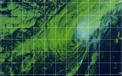
The latest tropical storm originating in Southeast Asia is now on its way towardsTaiwan and southern Japan, bringing with it heavy rain and the possible threat of flooding. The storm, dubbed Kong-rey, is now leaving the northern Philippines, where the cities of Laoag and Sinait experienced between 4 and over 6 inches (100 mm to 150 mm) of rainfall. Meteorologists are predicting the heaviest rain to fall on the mountains and eastern parts of Taiwan, beginning on Wednesday and into Thursday. Tropical Storm Kong-rey Tropical Storm Kong-rey will pass over slowly, with a small chance of it strengthening into a typhoon, but due to sticking to the east, damage-causing winds are expected to stay off the coast of the island. Authorities warn that the greatest threats to those in higher risk areas are flash floods and mudslides. Following Taiwan, Kong-rey will start on a path towards the northeast on Friday, affecting Japan that evening and through the weekend. High-speed winds will not be a concern by this point, but heavy rain should be expected on Japan’s southern island of Kyushu, and the southern region of Honshu, the country’s main island. Northern Honshu and Hokkaido will have their share of rainfall when a low pressure front moves in late in the weekend. Due to the terrain, once again flash floods and mudslides are warned to be the greatest danger, especially on Saturday. -JDP
 RSS Feed